Mapping & Geospatial Services
Mapping & Geospatial Services
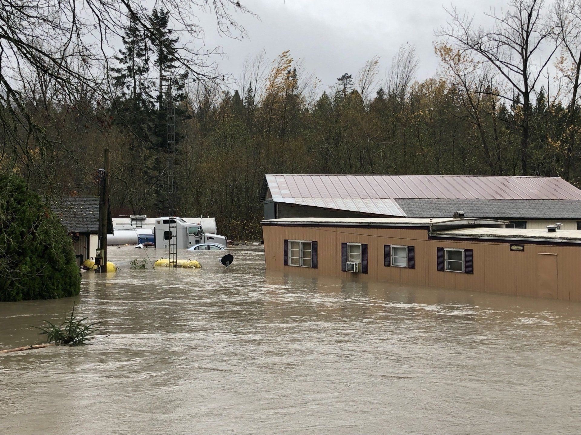
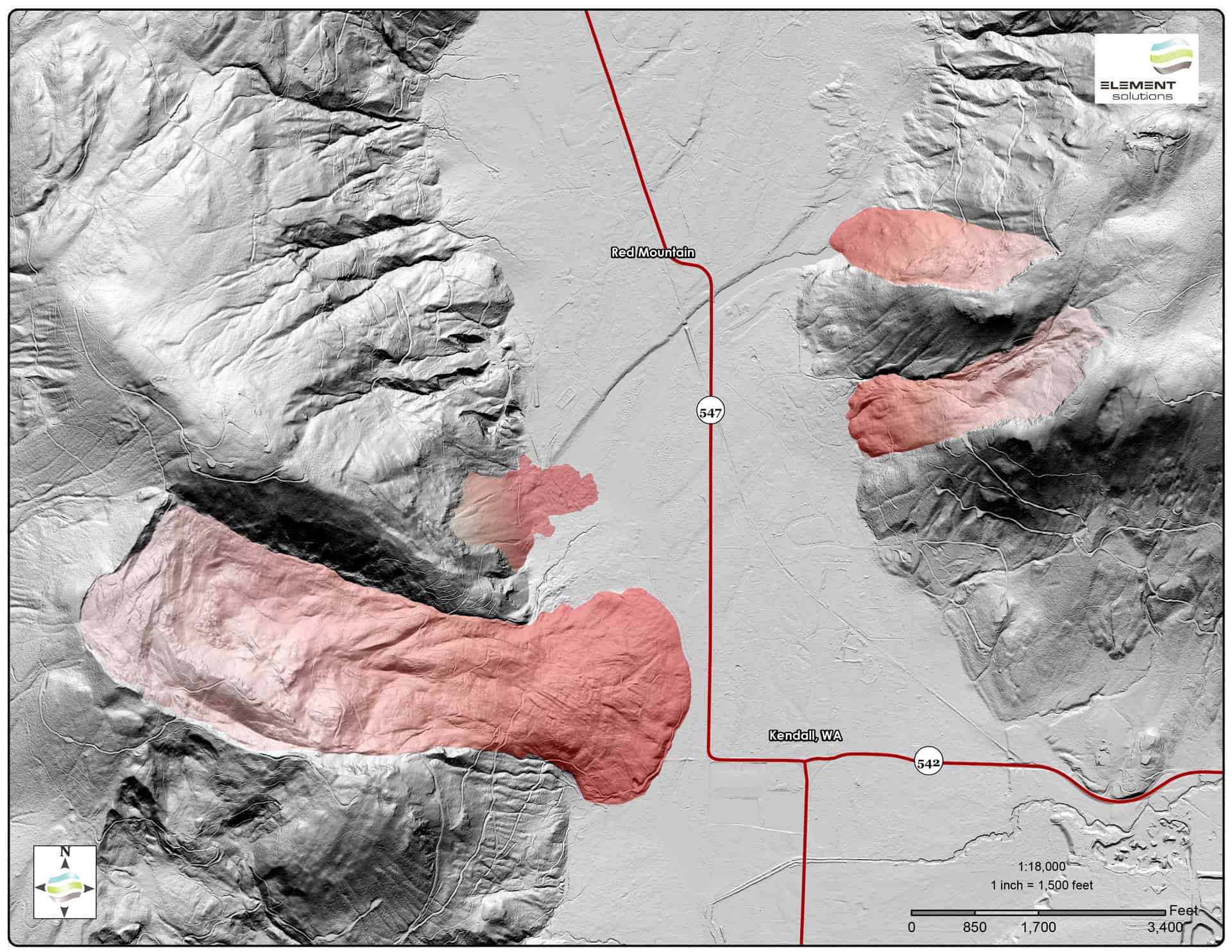
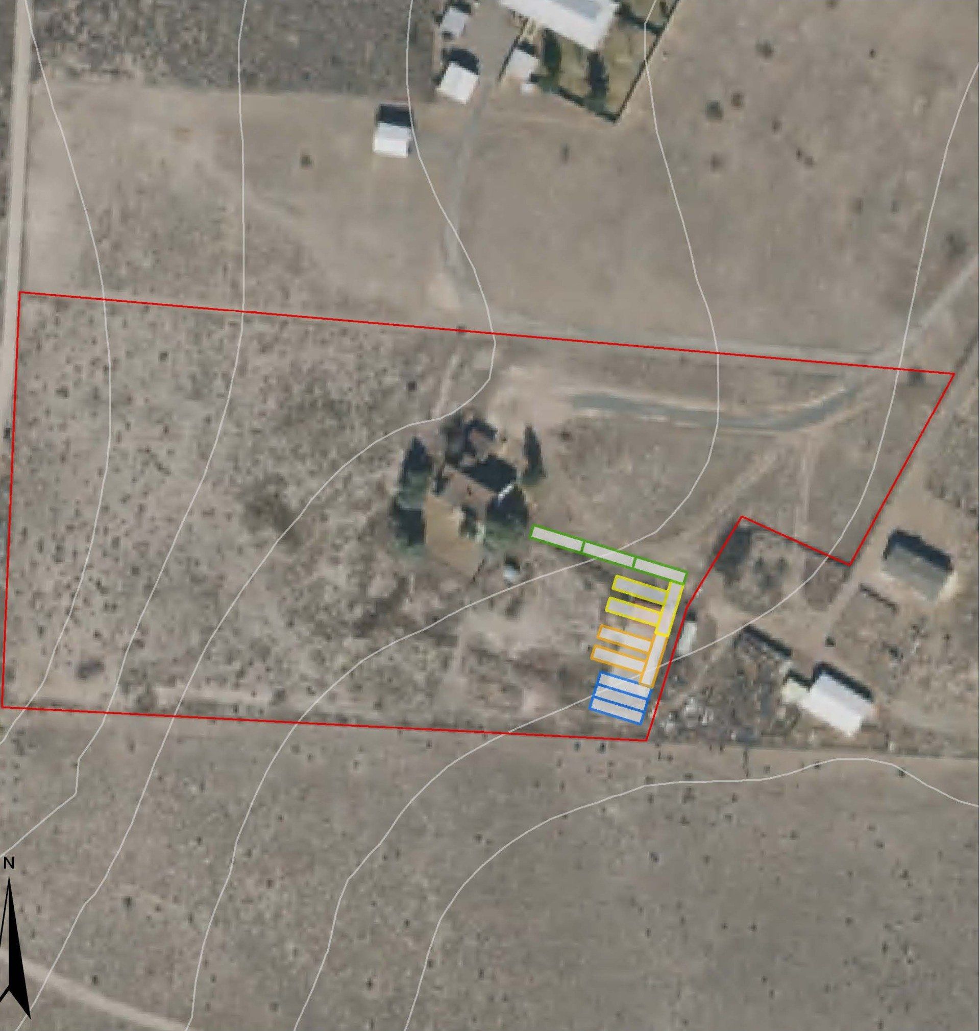
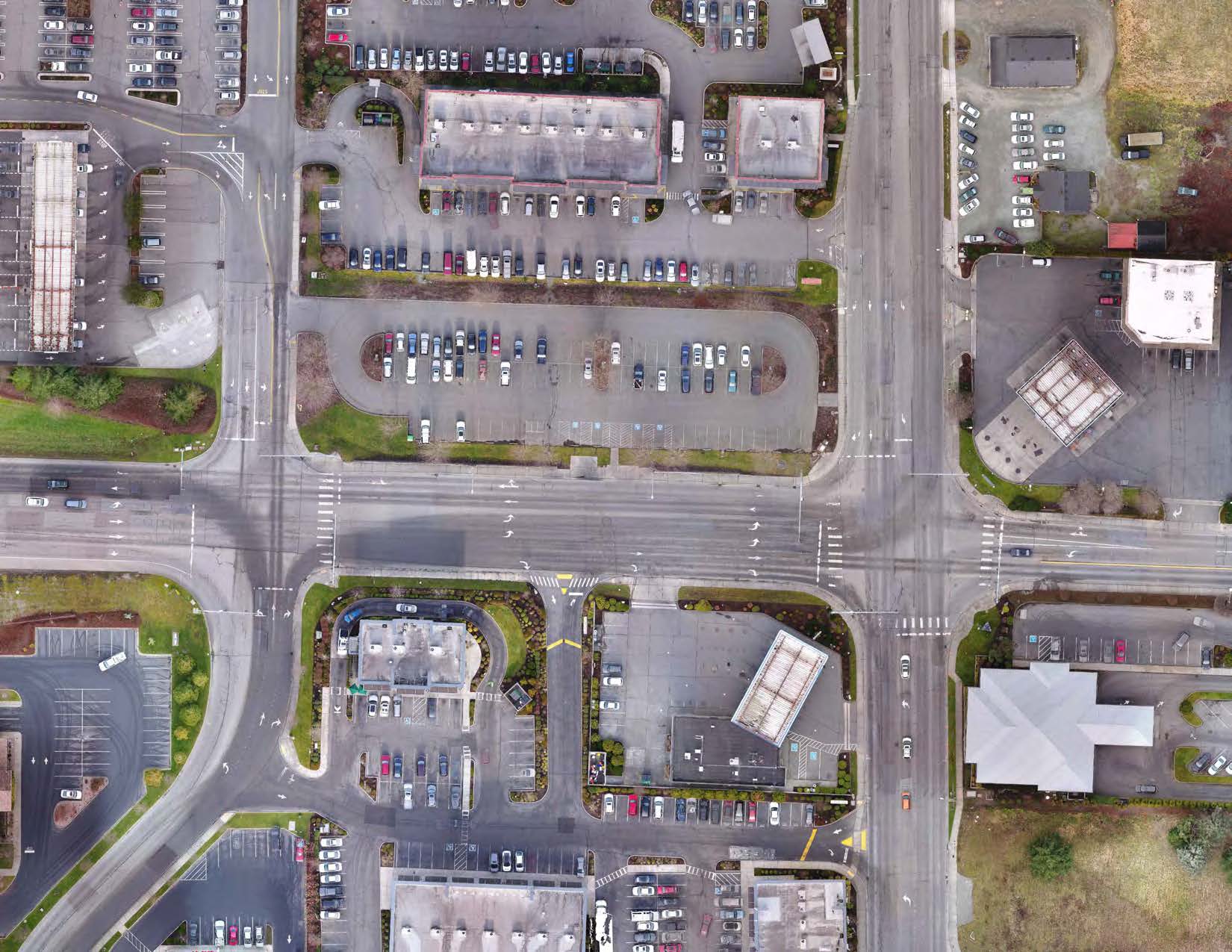
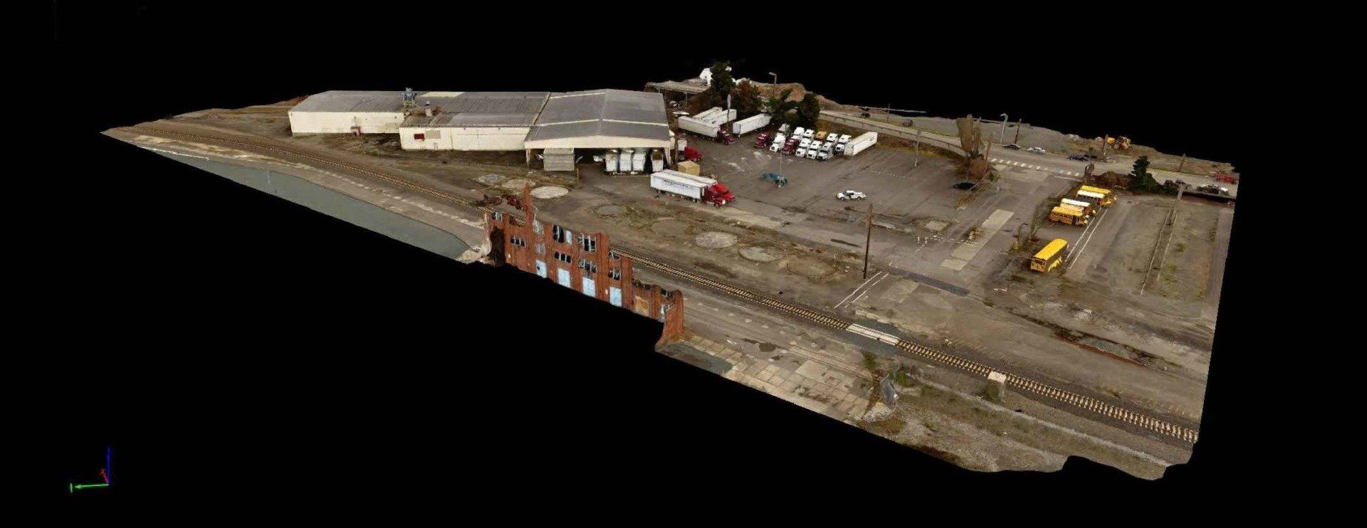
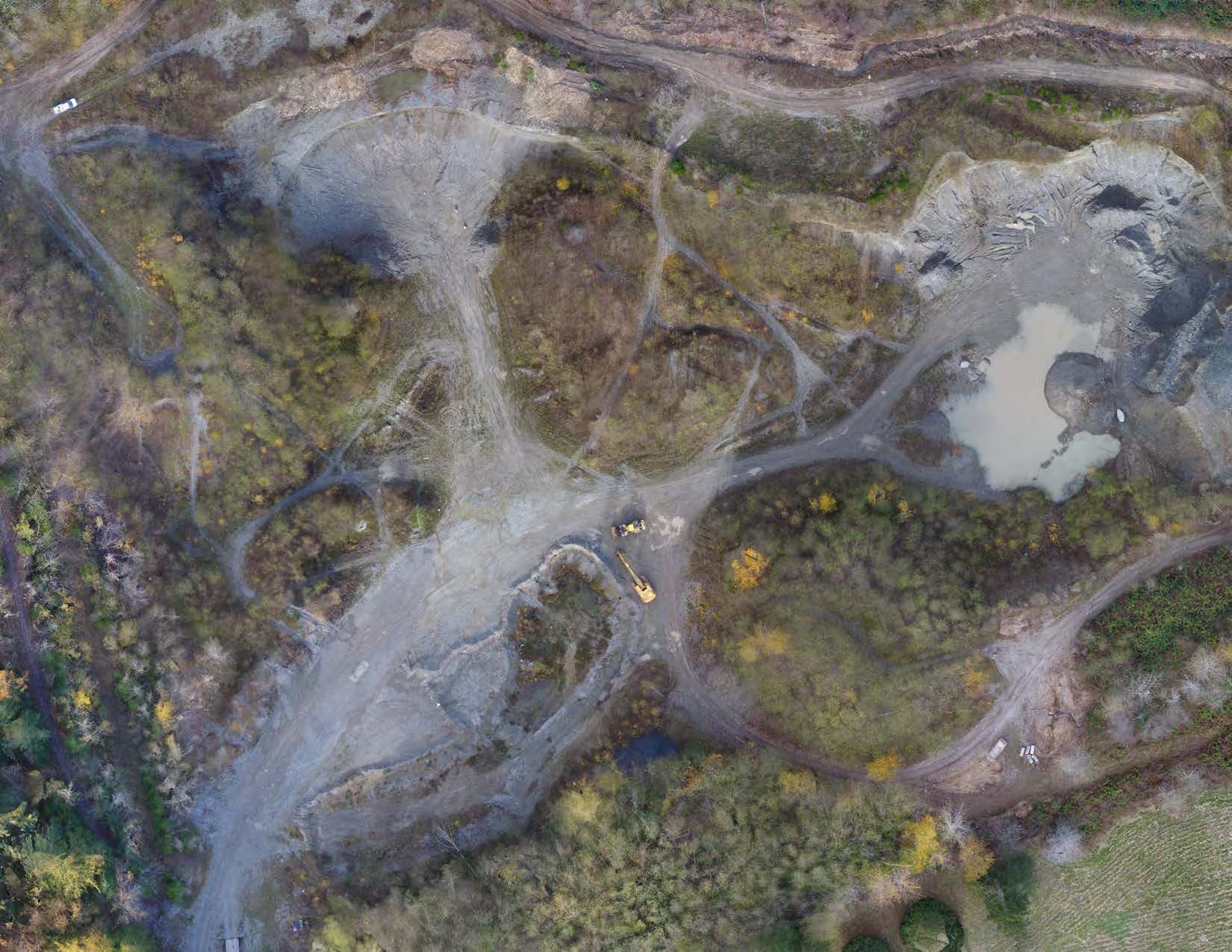
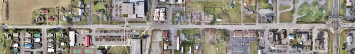
Element Solutions has robust capabilities for generating geospatial maps and project exhibits that are put to use with our scientific studies, as well as for support of work by others and our client’s endeavors. The ability to process, analyze, and display map data spatially is a cornerstone of Element’s geological and environmental work. We utilize publicly available LiDAR (light detection and ranging) and aerial imagery datasets to supplement our field interpretations and provide a most complete and accurate picture of existing site conditions. Additionally, Element’s affiliate company PSE offers full-scope surveying and CAD drafting services, and can collect a wide array of spatial data depending on your project’s needs. Element and PSE also have the capability to deploy unmanned air vehicle (UAV) drone technology to collect high-resolution aerial imagery of a site and produce maps quickly and affordably as an alternative or supplement to traditional mapping methods.
Element’s geospatial capabilities include:
- Geographic Information Systems (GIS) Analysis
- LiDAR-based Topography & Slope Gradients
- Vegetation & Biological Mapping
- Field GPS Data Mapping
- Dataset Integrations & Exhibit Preparations
- Volumetric Analysis
UAV Data Collection
Our endorsed, federally certified drone pilots (Part 107 Unmanned Aircraft Endorsement, Small UAV Rating) are trained to utilize unmanned aerial system (UAS or “drones”) technology to collect high-resolution spatial data remotely. Aerial datasets & imagery we provide of which can support your project include:
- Digital video & photography (real time, RAW, or post-processed)
- Ortho-rectified aerial photographs, spatially referenced to specified datum & mosaicked for seamless GIS or CAD interfacing
- Aerial Photogrammetric Surveying, Mapping & Modeling
- Environmental & Geo Hazard Mapping
- Volumetric Assessments & Monitoring
- Utility & Corridor Mapping
- Mining & Reclamation Mapping
- Construction Site Mapping & Monitoring
- Traffic Study Mapping
- Structural / Architectural Inspection & Mapping


Recent News