GIS for Geologically Hazardous Areas and Slope Analysis
Example Projects
GIS for Geologically Hazardous Areas and Slope Analysis
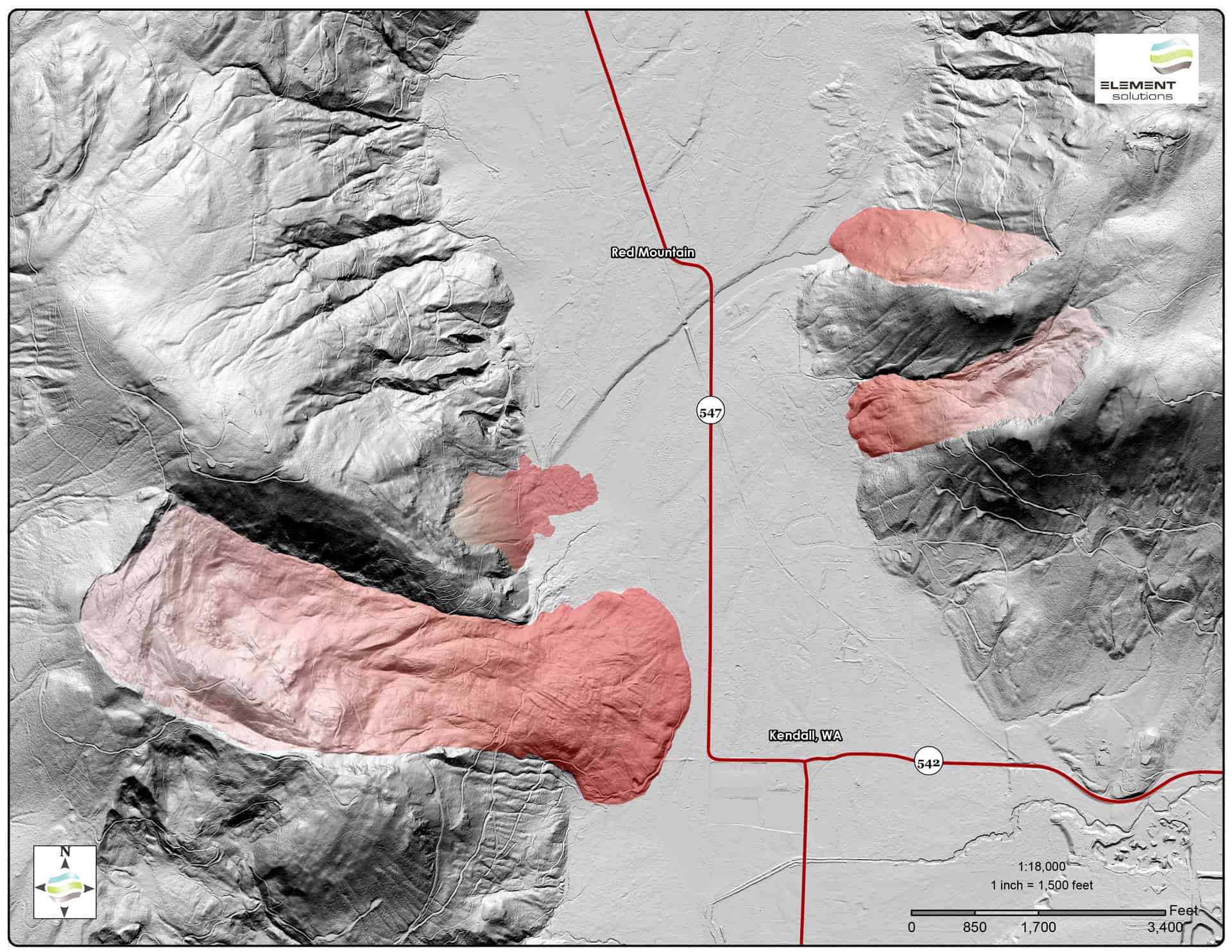
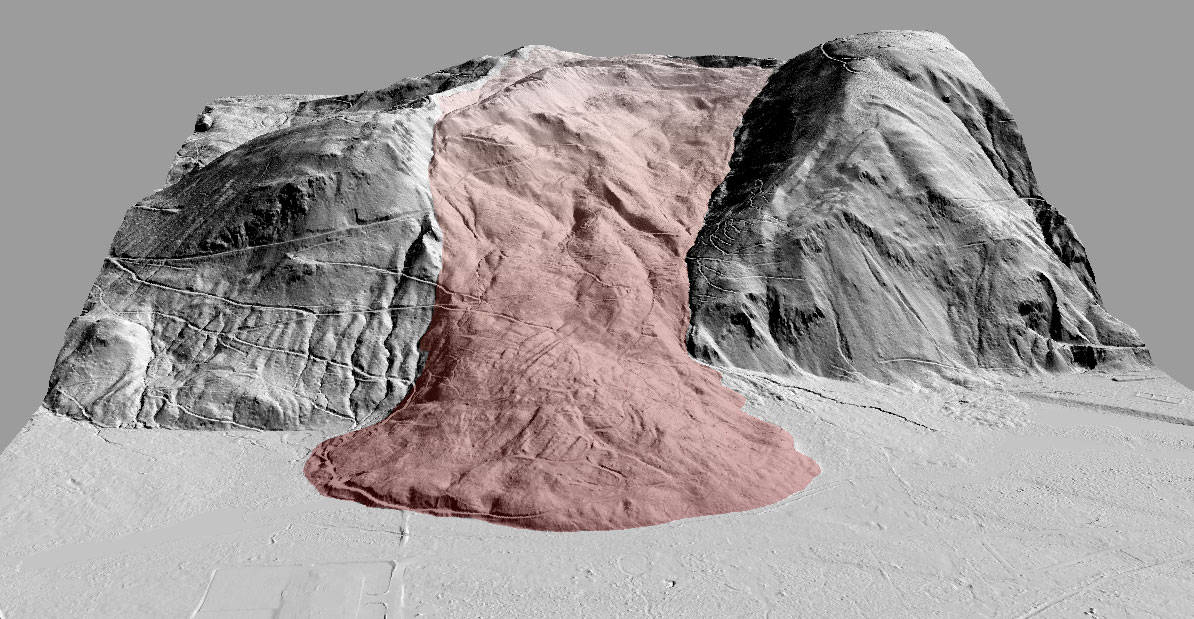
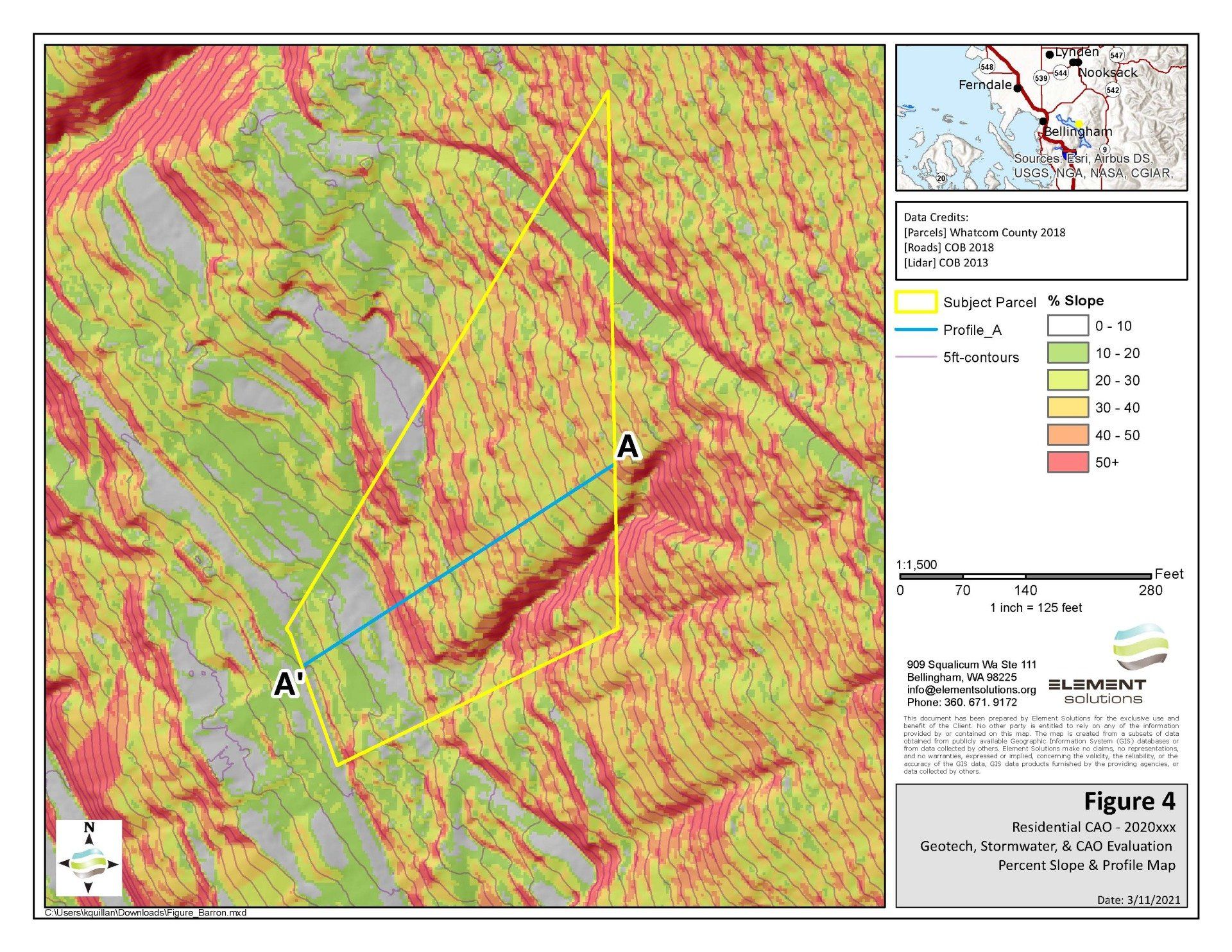
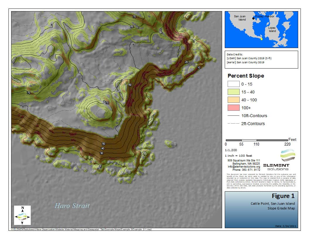
Element utilizes ArcGIS spatial analyst tools in conjunction with digital elevation model (DEM) data to pre-screen project areas for regulated slopes and potential geologically hazardous areas. We can also produce site-scale LiDAR-based topographic maps. This allows us to best focus our time in the field, and helps communicate findings visually to the end users in our reports. The exhibits produced by our in-house GIS services aid in presenting a representative and detailed picture of the existing landscape to our clients and reviewing agencies for project review and planning purposes. The example images demonstrate the power of our GIS imagery for site assessment purposes.